 Click here to download a map of local walks... (2.5MB)
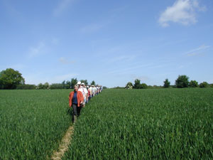
Coleshill is fortunate to have almost 15 miles of well maintained footpaths within the parish boundaries. These make up two circular walks of between seven and eight miles each, both of which pass by the Red Lion pub at the centre of Coleshill.
The East/West circuit starts from the Red Lion heading through woods and across fields, over the busy A355 Amersham - Beaconsfield road, over fields past Brentford Grange and reaching Bottom House Farm lane. Turning south along the narrow lane past Hales Woods and then through Hodgemoor Woods until emerging at The Magpie Pub on the A355.Turning off Magpie lane on footpaths past Ongar Hill Farm, Luckings Farm and emerging at Common with views of the windmill ahead of you. Across the common and fields towards Winchmore Hill, turning back to Coleshill in West Wood. Across more fields and passing Lands Farm, passing the side of All Saints church brings you back to the Red Lion.
The North/South circuit leaves the Red Lion turning right along Village Road, past the green triangle at New Road and through the woods and fields above Amersham. Turning back towards Coleshill a different path takes you back to Tower Road, past the cricket club and across the fields crossing the East/West circuit. Skirting around Bowers Farm across Magpie Lane and into fields past Ongar Hill Farm and on to Owlsears and Great Bears Woods. Returning through more fields past Luckings Farm and onto the Windmill Hill for a short walk back to the Red Lion
A full description of Coleshill Footpaths is available in a Footpaths and Bridleways map produced by Coleshill Parish Council in association with Buckinghamshire County Council and the Parish Paths Partnership, a Countryside Commission initiative. This handy pocket sized leaflet features illustrations of many historic Coleshill landmarks drawn by local artist Stephen Hitchen.
The Parish Council takes an active interest in maintaining clear footpath access and ensuring protection for rights of way. In the vent of any difficulty with footpath access of signage please email the Clerk to the Parish Council click here.
The Chiltern Society

The Chiltern Society publishes a definitive set of footpath and bridleway maps for the Chilterns. The Chiltern Society was founded in 1965 in response to wide concerns about the damaging developments and impassable footpaths of the Chilterns. The Chiltern Society has many specialised groups dedicated to maintaining the Chilterns.
These include:-
- Planning Team and Rights of Way Group - A regular programme of weekend and midweek walks is organised by this group
- Historic Works and Buildings Group
- Chiltern Conservation Volunteers
- Rivers and Wetlands Group
- Photogroup
- Cycling Group - A regular series of on and off road cycle rides is organised by this group
- Chiltern News is published quarterly and sent free to all members
If you would like to know more or would like to join visit the Chiltern Society web site at
www.chilternsociety.org.uk